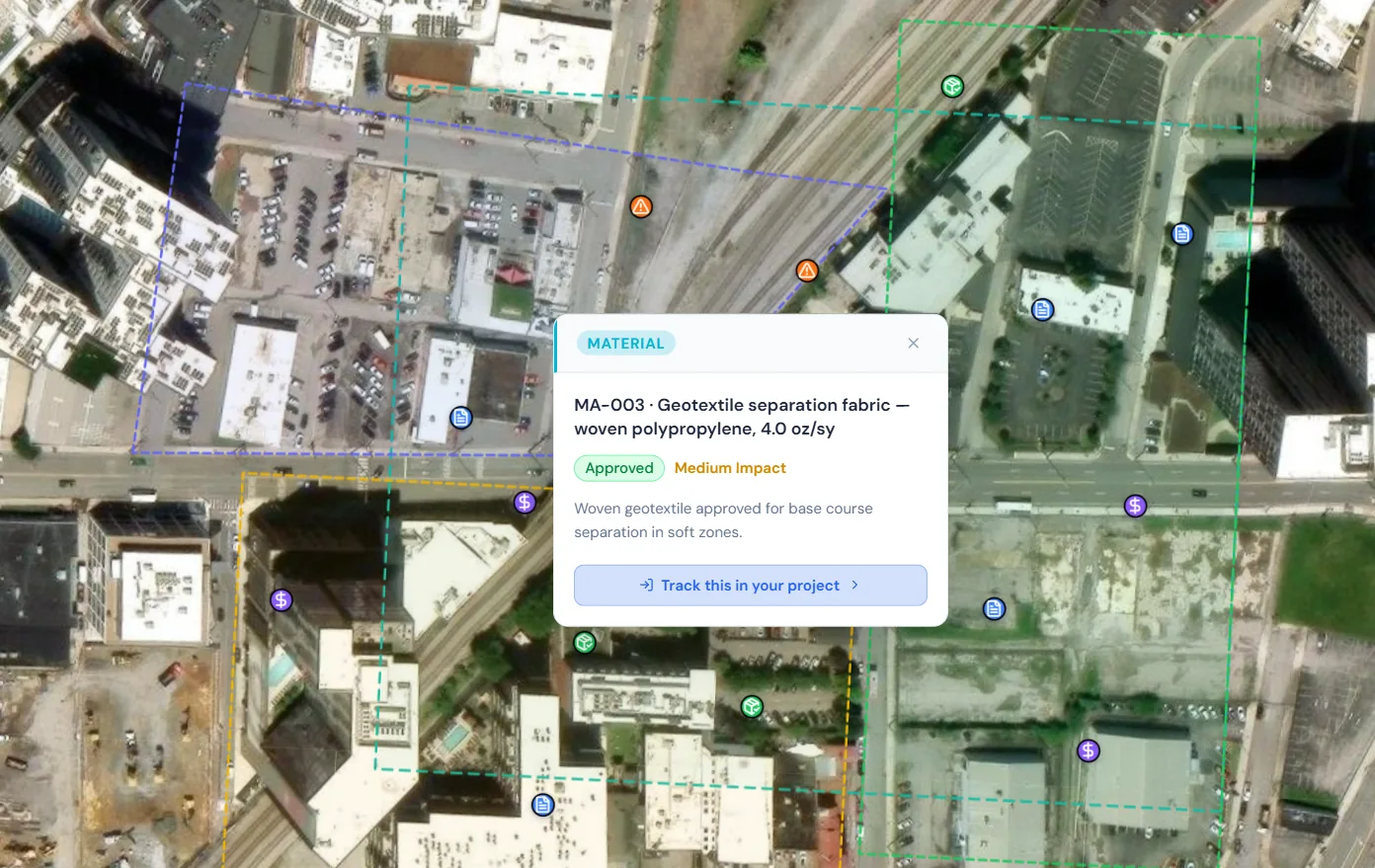
What is map-based job tracking software?
Map-based job tracking software organizes work by location, then connects each place to its current status and supporting information. A pin can represent a whole job, an estimate visit, or one issue within a larger project. Opening that location gives the team the context needed to decide what happens next, instead of searching separate address lists, photo folders, and message threads.
HeavyCivilHelper starts with the map and lets you configure the tracking categories around your work. Use Civil & Infrastructure for project documentation, Building & Trades for site-based work, or Bids & Estimates for opportunities and follow-up. The location stays central; the records and statuses describe what your team needs to track.
What you get
A geographic view of work and open issues
See nearby jobs and field conditions together. Color-coded pins and configurable statuses help distinguish work that is ready, waiting on information, or complete.
Geo-location pins for every job and lead
Place the work at its address or selected field location. Keep the relevant details, supporting photos, and related records connected to that place.
Route planning for site visits
Group job and opportunity locations into a visit sequence. Review the geographic estimate, open road navigation, and save your mileage log after checking the distance traveled.
Work zones, phases, and service areas
Draw the areas and alignments that explain how work is organized. Use zones as visual context for phases, access limits, and coverage discussions.
Photos and plan context at the same location
Connect field evidence to a map pin and review relevant plans. The Timestamp Camera can keep the selected capture time, location, and map or blueprint context visible on the finished photo.
Why not spreadsheets, sticky notes, or memory?
- An address column doesn't tell your crew which job is closest.
- Sorting by status hides the geographic clusters that actually matter for routing.
- A photo folder needs a separate explanation of which job or work area each image belongs to.
- A long workbook makes it harder to find site context on a phone.
- Work zones and service areas are easier to review when they are visible beside the jobs.
How map-based job tracking works
Start with one representative job. Put it at the right location, add the tracking details your team uses, and review it from both the field and the office.
- Locate the work. Place a job or issue pin at the site, address, or work area where it applies.
- Define what needs tracking. Choose a category and status, then add useful notes, records, and photos.
- Review and update. Use the map to plan the next visit, record the field condition, and give the office a shared reference.
Geo-location pins: every job at its real address
A job may cover an entire property, while an issue pin may mark one utility crossing, repair area, or inspection point. Place the pin where the information applies and attach enough context for the next person to understand it. GPS and map placement support field coordination; they are not a substitute for survey control.
Drop a pin at any address
Mark the site or specific work area instead of relying only on an address in a list.
Update from your phone on site
Review the record, update its status, and add site notes or photos while the context is fresh.
Saved updates for the office
Keep field updates in the shared project so the office can review the latest saved information.
One source of truth for the whole team
Give authorized estimators, PMs, and field staff the same location-based reference.
What Comes in HeavyCivilHelper?
Not a rigid system. A toolkit you configure.
Put the location, field photos, records, plans, and work areas on one map your team can use.
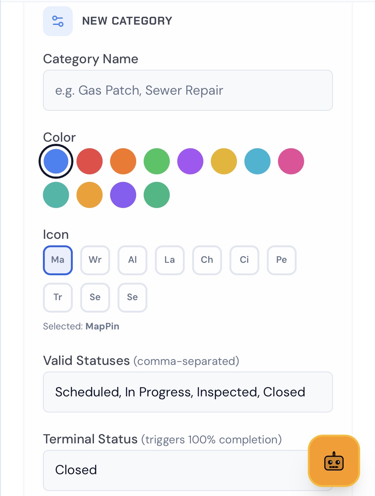
Set Custom Pins
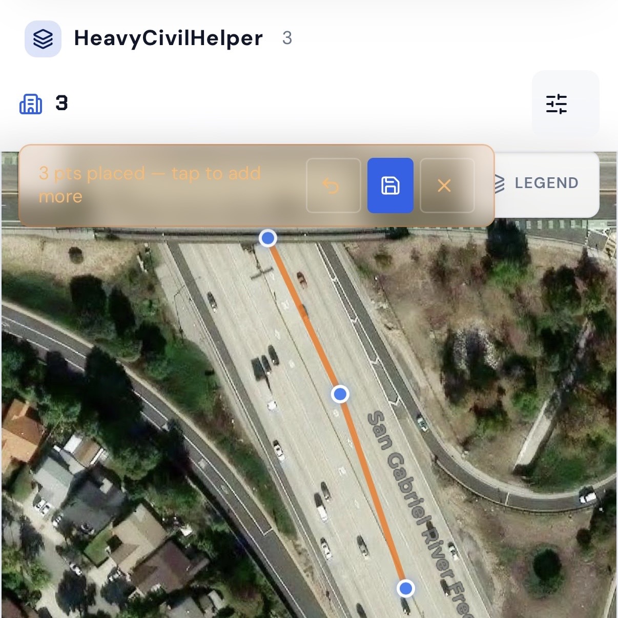
Draw Lines & Routes
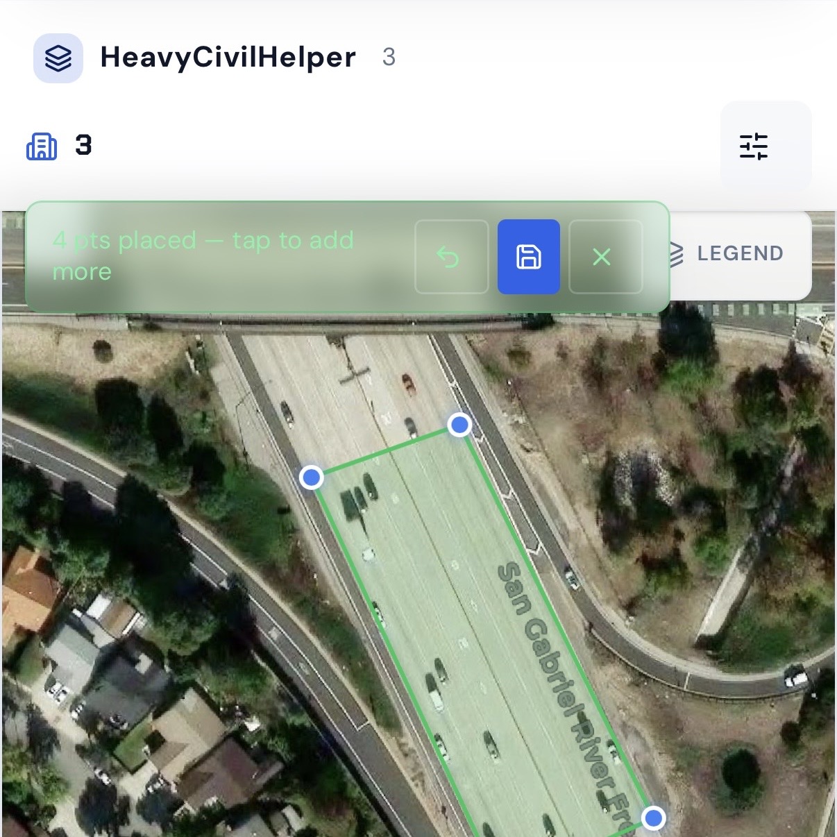
Group Work Zones and Phases
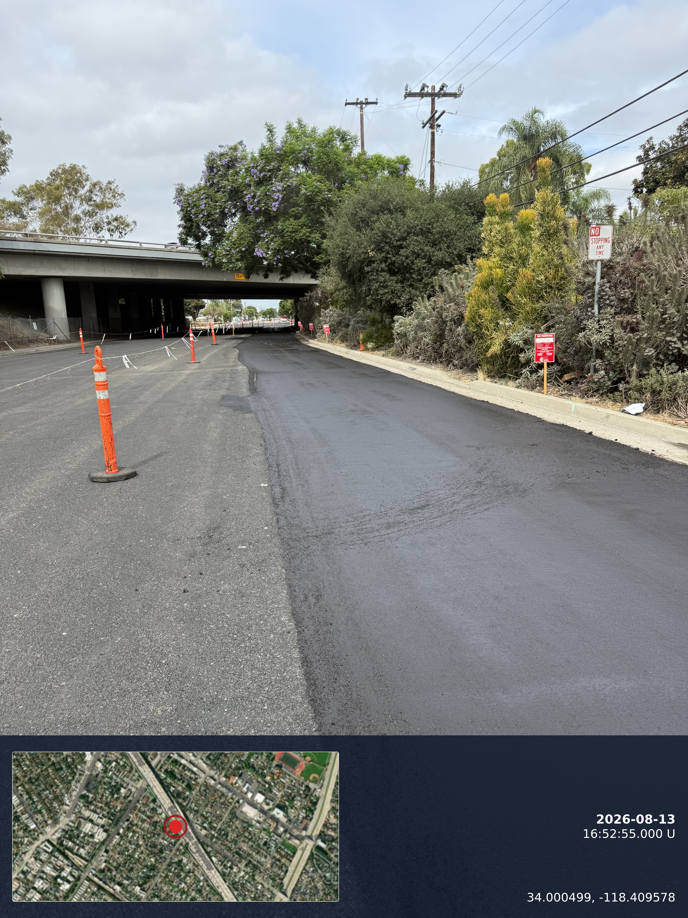
Timestamp Camera
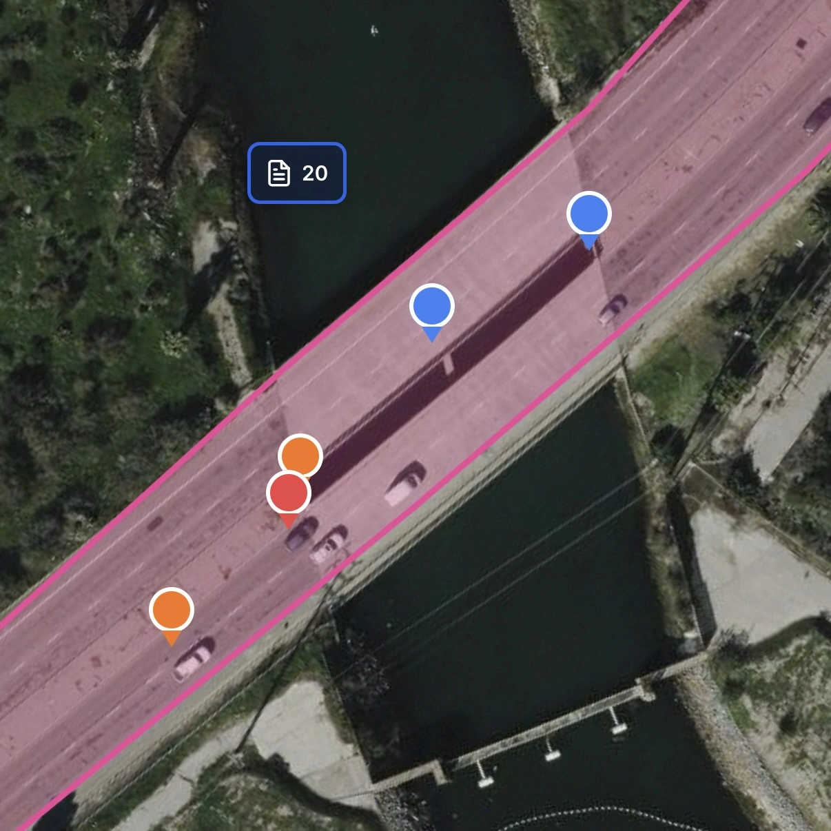
Track Multiple Records Pins
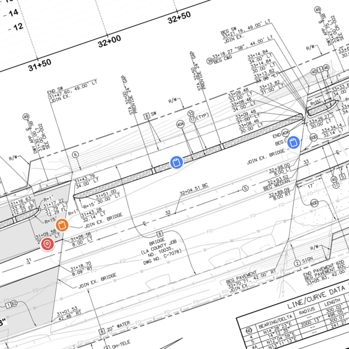
Overlay Plan Sheets
Create an account, choose Free, then add your first project.
Lead tracking: keep opportunities and site visits on the map
Before an award, track the property, estimate context, and next follow-up. During the work, track site conditions, progress, and unresolved issues. Keep the geographic context visible as your team's focus changes from winning work to delivering it.
For estimators and outside sales teams, nearby opportunities can be reviewed together before a site-visit day. Use stages and notes to distinguish a new lead from a property that needs an estimate or a follow-up conversation.
One Source of Truth
Aligned in Plan and Field Views
RFIs, directives, and field issues stay anchored to their real-world location as teams switch between the plan and live site.
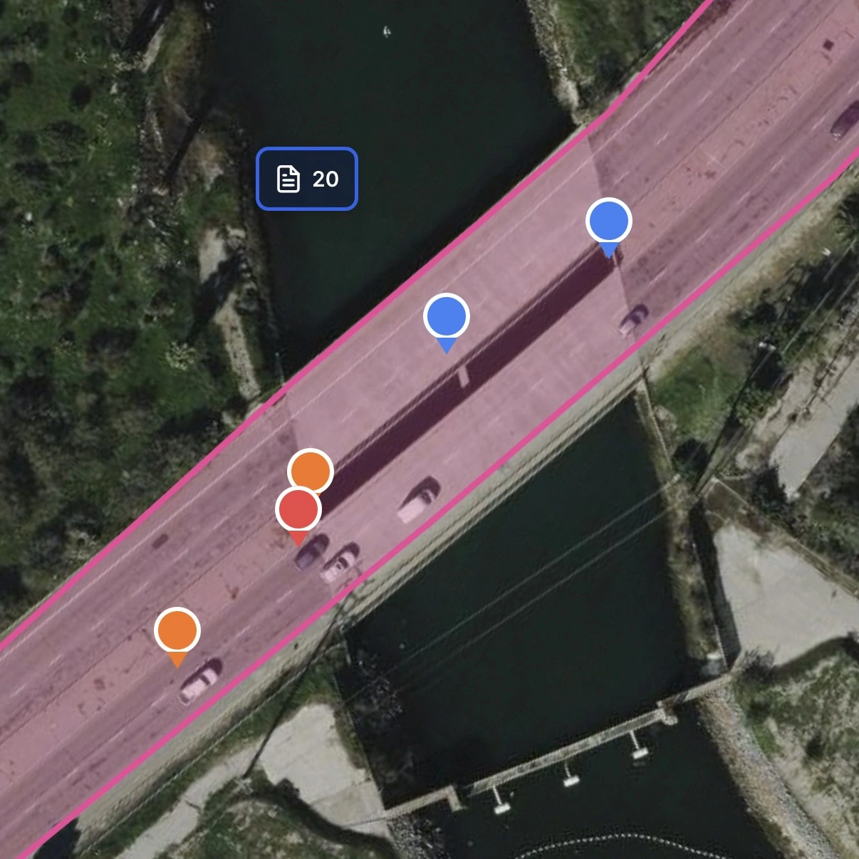
Territory management and work zones: make geographic limits visible
A drawn area can represent a service territory, construction phase, access restriction, or group of jobs. Displaying that area beside the pins helps the team discuss coverage and work sequence. Zones describe geographic context; they do not automatically dispatch workers or restrict project access.
- Draw territory boundaries directly on the map by hand
- Name areas for the phase, service region, or work package
- Use configured pin categories and statuses to distinguish work
- Review nearby opportunities together before planning site visits
- Confirm project sharing separately from the visual zone boundaries
- Compare mapped work with the areas your team needs to cover
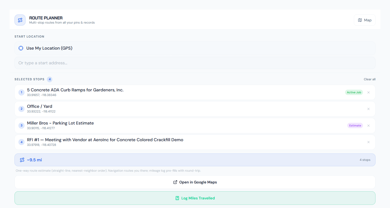
Route planning and optimization: review the day's stops geographically
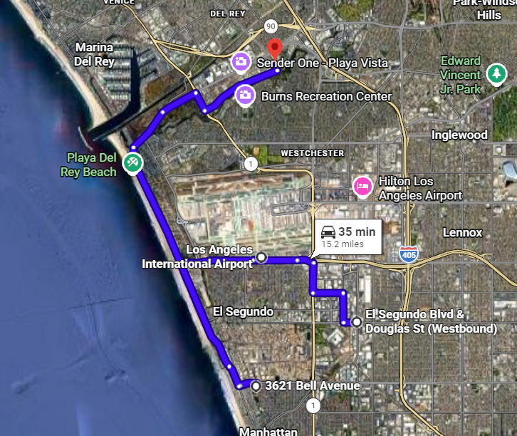
Add the job locations you need to visit, review the stop sequence, and open navigation for driving directions. HeavyCivilHelper uses straight-line distances and nearest-neighbor ordering for its geographic estimate, not live traffic or measured road mileage. Review the miles traveled before saving a mileage entry; the app does not continuously track your vehicle or log a drive automatically.
Add jobs as route stops
Use mapped job locations as the starting point for a multi-stop visit.
Reorder by geography
Review the geographic sequence, then use road navigation to check the actual trip.
Review and save mileage
The log pre-fills an estimated round trip. Check or edit the miles, date, and notes before saving.
Site-visit context
See nearby work and opportunities while planning the next visit. Job pins do not show live crew positions.
Who uses map-based job tracking
A geographic view helps at different scales: a corridor, a building site, a set of customer addresses, or a group of opportunities. Here are practical ways different teams can configure the toolkit.
Bids, Estimates & Outside Sales
Map opportunities, site visits, and follow-up locations. Keep estimate context near the property or work area, then update the tracking stage as the opportunity develops.
Field Service & Utilities
Locate service calls, utility conflicts, inspection points, and maintenance work. Keep access notes and supporting photos with the site so the next person has usable context.
Building & Trade Contractors
Track paving, concrete, roofing, landscaping, and other address-based work. Use configurable statuses to distinguish work that needs an estimate, a visit, or completion.
Civil & Infrastructure
Put RFIs, directives, material questions, and field issues along the road, utility, bridge, or drainage project where they apply. Connect the location to its plans and evidence.
What a job site pin contains
Each pin on the map is a self-contained job file. Everyone on the team — the estimator, the crew lead, the PM, and the office — looks at the same information from the same pin. Nothing gets lost in a text thread or buried in a spreadsheet tab.
Job scope and contract value
Use the appropriate job or opportunity record to describe the work and relevant value. Not every pin type has the same fields.
Status and stage
Configure stages that match the work, such as estimate needed, scheduled, in progress, and complete. Update the relevant record as the condition changes.
Responsibility and next action
Keep the responsible contact and next step in the relevant record or notes. Use project sharing to control who can access the work.
Field notes and photos
Site conditions, before/after documentation, access instructions, customer notes — all attached to the location where they're relevant.
Customer contact info
Keep relevant customer or site-contact details with the job or opportunity record, where authorized teammates can find them.
Coordinating multiple crews geographically
When several crews work across different sites, review the mapped jobs and unresolved conditions together. Nearby work may share access constraints, equipment needs, or a useful site-visit window. Confirm availability with the people doing the work rather than assuming a pin shows a crew's current position or schedule.
- Review job locations and saved statuses before coordinating visits
- Identify adjacent jobs that could fill schedule gaps
- Identify nearby work where teams may be able to share equipment
- See the geographic spread of the day's work before anyone leaves the yard
Watch how it works
A quick tour of map-based job tracking: pinning new jobs, updating status from the field, and seeing your whole book of work at a glance.
Common questions about map-based job tracking
- What is map-based job tracking software?
- Map-based job tracking software connects jobs and field records to the places where work happens. Instead of searching an address list, a team opens a map, selects a location, and reviews its status, notes, photos, and related records. HeavyCivilHelper supports this workflow for civil projects, building and trade work, and bids and estimates.
- What are geo-location pins in job tracking?
- A geo-location pin marks a job, opportunity, or field condition at a selected map location. It can represent an entire site or a specific work area, such as a driveway, utility crossing, inspection point, or material issue. Configure the pin category and status, then keep supporting records and photos connected to the location.
- How does route optimization work for field contractors?
- Add job locations as stops and use the route planner to arrange a geographic visit sequence. HeavyCivilHelper's estimate uses straight-line distances and nearest-neighbor ordering; it is not a traffic-aware driving distance or a guaranteed fastest route. Open navigation for road directions, then review and save miles traveled in the mileage log. Mileage is not recorded automatically as you drive.
- What is territory management in job tracking software?
- Territory management uses geographic areas to organize coverage and follow-up. Drawn zones and color-coded pins help teams describe service areas, work phases, and groups of opportunities. Those visuals support coordination; drawing a zone does not automatically dispatch a crew or create a separate access boundary for a rep.
- Who uses map-based job tracking software?
- Map-based job tracking is used by field service and utilities teams (technicians navigating between service calls), outside sales reps (roofing, solar, gutters, home improvement canvassing), small contractors (asphalt, concrete, paving, landscaping), and heavy civil crews (road, utility, and infrastructure work). Any business where the work happens at addresses benefits from organizing those addresses on a map instead of in a list.
- How is this different from project management software like Procore or Buildertrend?
- The difference is the starting point: HeavyCivilHelper organizes work around a project map and the locations of its records, photos, plans, and issues. That map can support existing office workflows rather than replace every accounting, scheduling, or project-management system. Review the features and plan limits against your team's requirements before choosing software.
- Can my crew update job status from their phones?
- Yes. Use the web app or HCH Field to work with authorized project records from a phone. Review the location, update the relevant status or notes, and add supporting photos within your account's allowance. Saved updates give the office a shared project record when connected. A job pin marks the work location; it is not a live GPS tracker for the crew.
- Does it work for asphalt, concrete, and paving contractors?
- Yes. Map each driveway, parking lot, paving area, or repair location and configure statuses that match the work, such as estimate needed, scheduled, in progress, or complete. Keep access notes, site photos, and scope questions with the location. Use the route planner when visiting multiple sites, without treating the map as an automatic dispatch or invoicing system.
- How many jobs can I track at once?
- Project, pin, attachment, and team allowances depend on your HCH plan. Start with the Free plan to test the workflow and review the pricing page for current limits before moving a larger job list into the app. Free includes five successful attachment uploads for the account's lifetime, shared across Web, Field, and Lens; deleting an attachment does not restore a slot.
- What makes a job tracking app good for field crews specifically?
- Look for a clear location view, statuses that match your work, accessible notes and photos, and a practical phone workflow. Check sharing permissions, attachment limits, and how field updates reach the office. Try a representative job in the public demo instead of judging the software only by a feature list.
See it on a real map
The interactive demo loads sample data so you can click through it in under a minute.
Related
Construction Timestamp Camera
Add capture time, location, and map context directly to before-and-after job photos.
Track Leads on a Map
Map-based lead pipeline with territory management and follow-up tracking for outside sales teams.
For Small Contractors
Asphalt, concrete, paving, handyman, and mowing: job tracking built for service crews.
Map-Based Field Coordination
For heavy civil and public works teams: RFIs, directives, submittals, and plan overlays on the map.
Simple CRM for Contractors
Track leads and customer history on the same map your crews use for active jobs.
Plans and Tracking Limits
Review current project, attachment, and team allowances before choosing a plan.