What you get
Every plant is a GPS pin — not a row in a spreadsheet
Each agave, lantana, mesquite, or bougainvillea is pinned at its exact plan location on the satellite map. Category, quantity, installer name, installed date, and city inspection status are attached to that pin. Your PM sees what's in and what's not without leaving the truck.
Rock mulch zones pinned by material and coverage area
Decomposed granite sections, river rock borders, and crushed stone accent areas are each a pin on the corridor map. Log tonnage delivered, coverage achieved, and compaction verified — at the location where the material was placed, not in a general project note.
Tree installations documented with arborist spec compliance
Each 24" box tree is a pin with rootball depth, stake count, TreeGator bag status, and city arborist sign-off date. When the warranty period starts or a replacement is needed, the original install record is right there — no searching for the paper tag.
Irrigation and electrical POC documented at the connection point
Drop a pin at each city water meter tap, backflow preventer, and SCE service connection. Log the permit number, test result, and contractor license. Every POC is documented before the inspector shows up — not assembled from memory the morning of the walk. Works alongside custom pin categories for each connection type.
Status flows from Scheduled → Installed → Inspection Due → Accepted
Each pin has a status your whole team and the city inspector can see. When a plant is flagged, the status and the reason are in the pin note — no whiteboard, no extra call to the super to find out what got rejected and why.
Photo documentation tied to the GPS location
Field photos attach directly to the pin — before planting, rootball placement, finished mulch cover. Timestamped and GPS-tagged at that station. Plant warranty disputes and punch list conversations start with photos, not arguments.
Why not spreadsheets, sticky notes, or memory?
- A spreadsheet row for 'DG zone, Station 14+00' doesn't tell a field crew where on the median to start or how much was already placed yesterday.
- Plant inspection status in a shared spreadsheet is already wrong by the time someone updates it from the tailgate — in HeavyCivilHelper the pin is updated at the plant.
- When the city inspector asks about the POC backflow test result at the west meter, your PM shouldn't be searching a binder while the inspector waits at the curb.
- Twelve agave clusters, three mesquite trees, two POCs, and four rock mulch zones read in thirty seconds on a satellite map. The same list takes minutes to parse from a spreadsheet — if it's even current.
- Replacement and warranty tracking in a spreadsheet means another column, another tab, another version of the file. In HeavyCivilHelper the replacement is logged at the same pin — original install, failure, replant, re-acceptance all in one place.
What Comes in HeavyCivilHelper?
Not a rigid system. A toolkit you configure.
Put the location, field photos, records, plans, and work areas on one map your team can use.
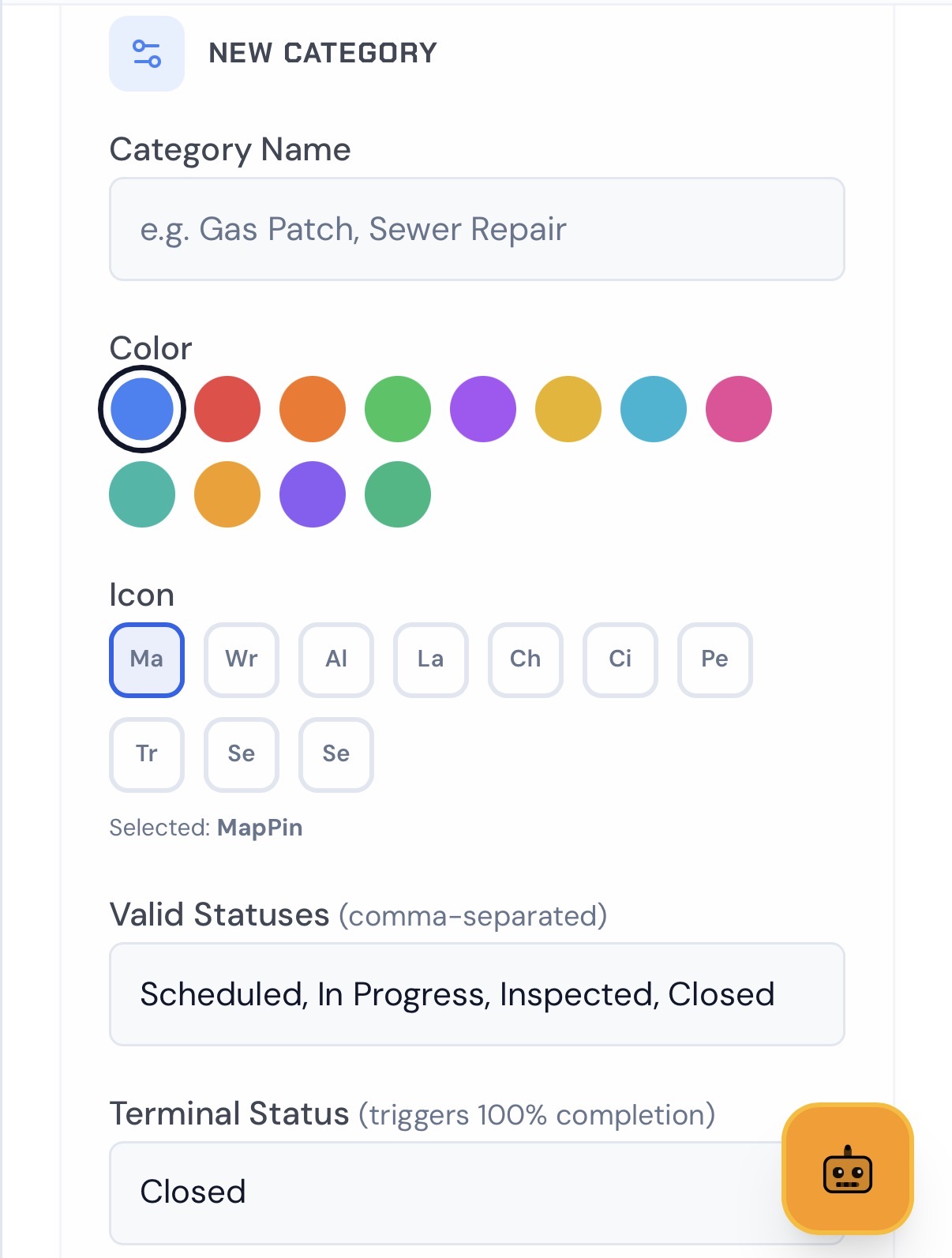
Set Custom Pins
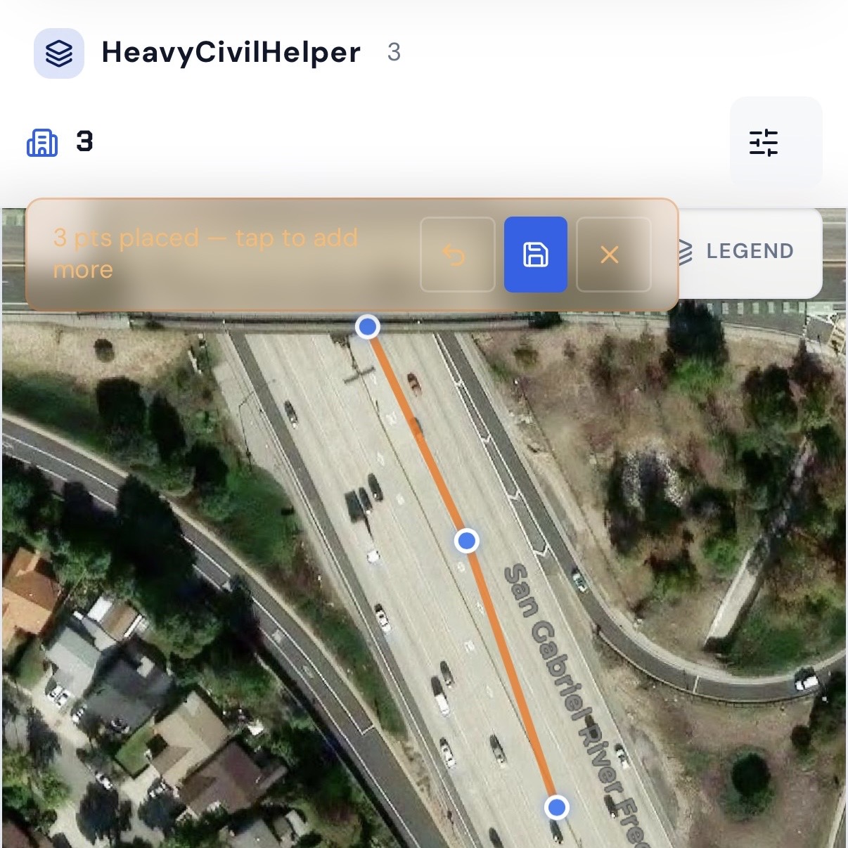
Draw Lines & Routes
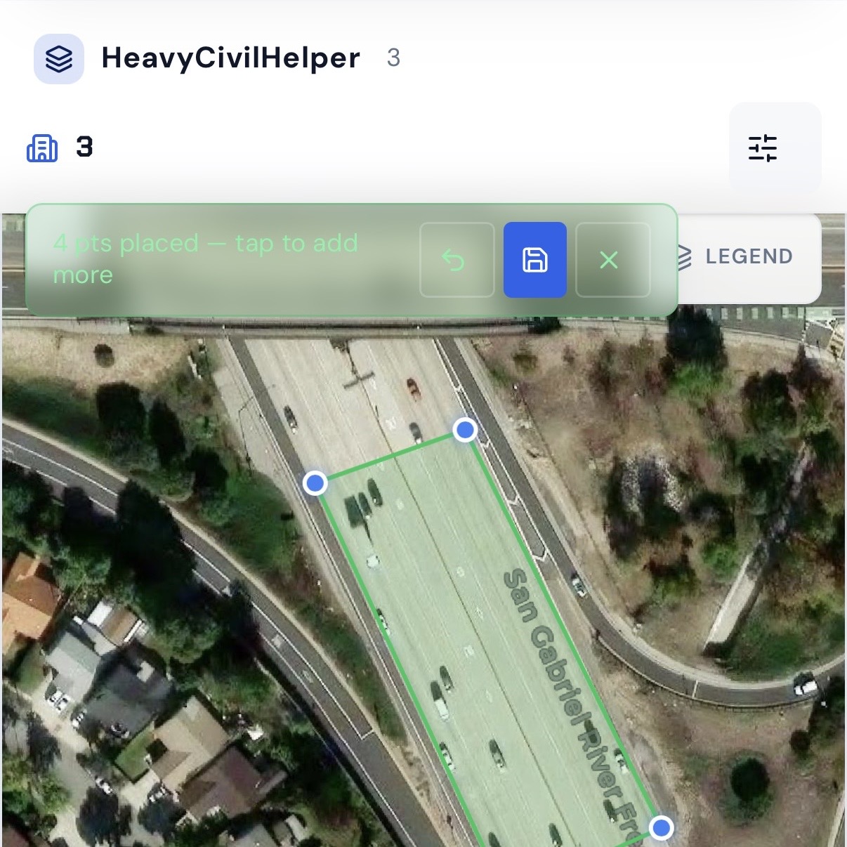
Group Work Zones and Phases
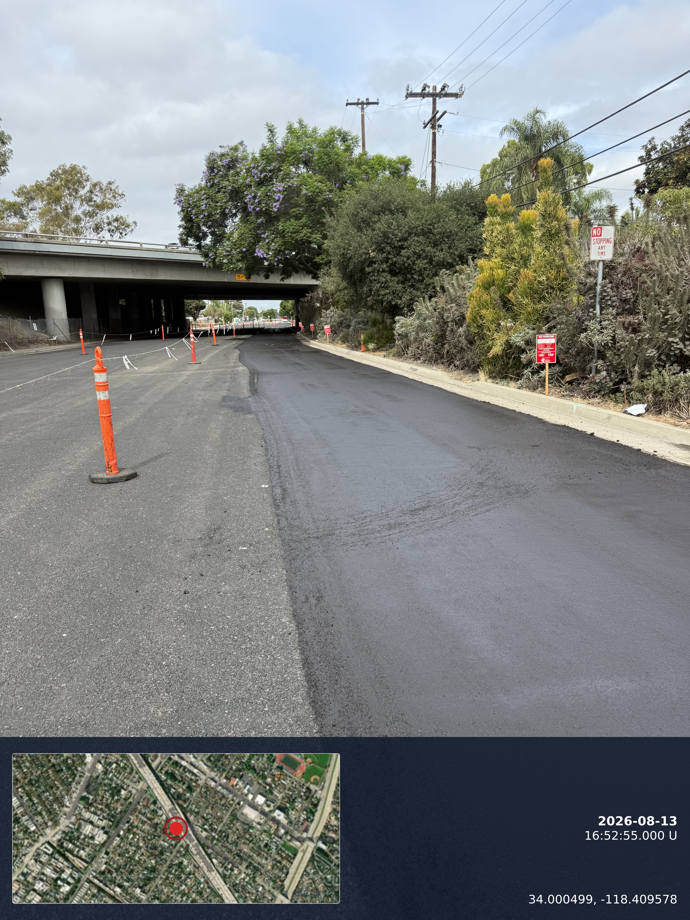
Timestamp Camera
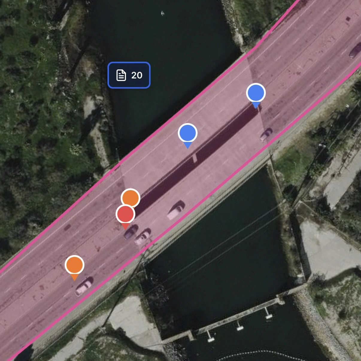
Track Multiple Records Pins
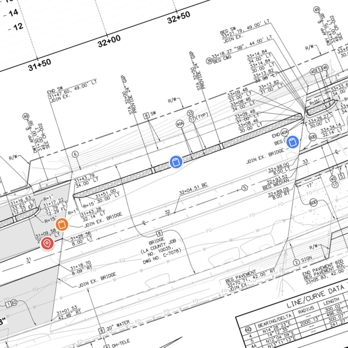
Overlay Plan Sheets
Create an account, choose Free, then add your first project.
Frequently asked questions
Does HeavyCivilHelper work for landscape subcontractors on city median and streetscape projects?▼
Yes. Median and streetscape work is highly location-specific — every plant, tree, rock mulch zone, and POC has an exact spot on the plan. HeavyCivilHelper puts each one on a GPS satellite map as a pin. Your foreman sees exactly what's in, what's still scheduled, and what's awaiting city inspection — all from the map, without calling the crew.
How do we track individual plants and rock mulch zones across a long corridor?▼
Each installation element is its own pin on the satellite map — agave cluster at Station 12+40, river rock border starting at Station 14+00, Chilean mesquite at the entry feature. You name pin categories by material type (rock mulch, 1-gallon shrubs, 24" box trees, POC), assign colors, and see every item at once on the corridor map. No plan sheet flipping, no spreadsheet.
How do we document POC connections to city water and SCE electric?▼
Drop a pin at the exact location of each irrigation POC and controller power connection. Log the permit number, meter ID, backflow test result, and electrician license number at that pin. When the city inspector asks for documentation at the POC, the permit, test report, and contractor info are already in the pin notes — not buried in a jobsite binder.
Can we track plant replacement and warranty callbacks on the map?▼
Yes. If a plant dies or fails inspection, update the pin status and add a note. The replacement date, replant crew, and re-inspection result are logged at the same pin. When the city calls about a warranty item at Station 18+60, you can pull the full history of that exact location — original install, failure, replacement, and re-acceptance — from one pin.
Can the city inspector or GC see the map?▼
Yes. Share project access with the resident engineer, city landscape inspector, or GC. They see the same live map — each pin's status, notes, and photos — without needing to call your foreman for a status update. Fewer calls, fewer surprises at the final walk.
Can we attach photos of each planting location?▼
Yes. Attach field photos directly to the pin — pre-plant site condition, rootball placement, backfill depth, mulch coverage, and post-install appearance. The photo is timestamped, GPS-tagged, and tied to that specific location. Plant warranty disputes and city punch list conversations start with documented photos, not memory.
See it in action
A corridor project on a 6-lane arterial median — rock mulch zones, agave clusters, desert willow trees, a Chilean mesquite, irrigation POC to a city meter, and an SCE electric connection for the controller. Every item is a GPS pin with material, quantity, installer, and status.
See it on a real map
The interactive demo loads sample data so you can click through it in under a minute.
Related
Environmental Service Companies
For companies deploying BMPs, portable restrooms, and fence rental to job sites — the same pin-and-track model for field equipment.
SWPPP Practitioners
For QSPs managing BMP inspections and NPDES compliance — GPS-pinned erosion control alongside your landscape scope.
Custom Pin Categories
How HeavyCivilHelper lets you define plant and material categories — agave, mesquite, DG, river rock, POC — with distinct colors and your own labels.
Public Works & Heavy Civil
For the GC or agency managing the overall project — how the landscape sub's pin map connects to the rest of the project.