Fieldwire alternative for civil contractors
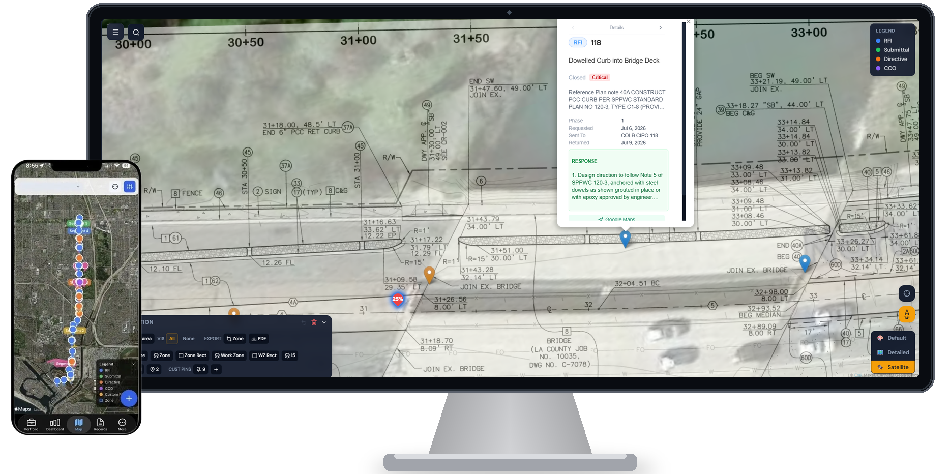
Fieldwire is a plan markup and task management tool built primarily for GCs managing punch lists and drawing workflows. HeavyCivilHelper is a GPS map-first field coordination platform for civil contractors who need every RFI, directive, submittal, and field issue pinned to the exact location where it applies — not organized in a task list.
The mismatch shows up most clearly on growing civil teams: Fieldwire's per-user pricing scales against you as you add crew members, and its drawing-centric interface was not built for the way a civil superintendent or field PM navigates a corridor project. HeavyCivilHelper was.
Honest framing
This comparison is not "HeavyCivilHelper is better than Fieldwire." Fieldwire is a construction task management and plan markup platform — originally built for punch lists and drawing markups, now owned by Hilti — designed for general contractors who need drawing version control, task assignment, and punch list workflows. If your operation requires drawing version control, task-level punch lists, and plan markup workflows for a general contractor running multiple trades, Fieldwire does that well and is widely deployed on commercial construction projects. HeavyCivilHelper is a map-first field coordination layer — a different tool for a different workflow.
Why pricing matters more as your civil team grows
A civil contractor running a multi-segment public works corridor often has 10-30 people who need project visibility: supers, foremen, PMs, a sub or two, and an agency inspector. Per-user pricing that made sense at 5 people can double or triple the software cost as the job scales up. Fieldwire's per-user model was designed for commercial GC teams where software cost is a line item in the GC's overhead. Civil specialty contractors feel it differently.
How the workflows differ
Fieldwire organizes work around tasks and drawings. HeavyCivilHelper organizes work around GPS locations.
In Fieldwire, a task is the core unit. You create a task, assign it to someone, attach it to a plan location, and track it through a checklist. That workflow is exactly right for a GC punch list — a superintendent walks a building, notes deficiencies, assigns them to subs, and closes them out. The interface is built around that loop.
In HeavyCivilHelper, a GPS pin is the core unit. An RFI is a pin at the station where the field conflict exists. A directive is a pin at the location where scope changed. A submittal is a pin tied to the structure it governs. The entire interface is a live satellite map — not a drawing viewer layered over a task list. When a foreman opens the app on a corridor project, they see their GPS location and every open item around them in geographic context.
Civil projects are inherently geographic. The work moves along a corridor. The questions and changes are tied to specific stations, structures, and intersections — not to a drawing sheet number. A map-first interface matches the way civil crews actually navigate their work.
One Source of Truth
Aligned in Plan and Field Views
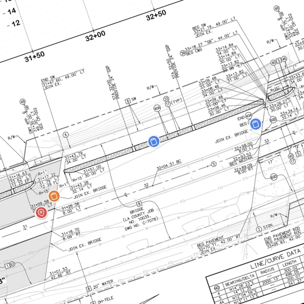
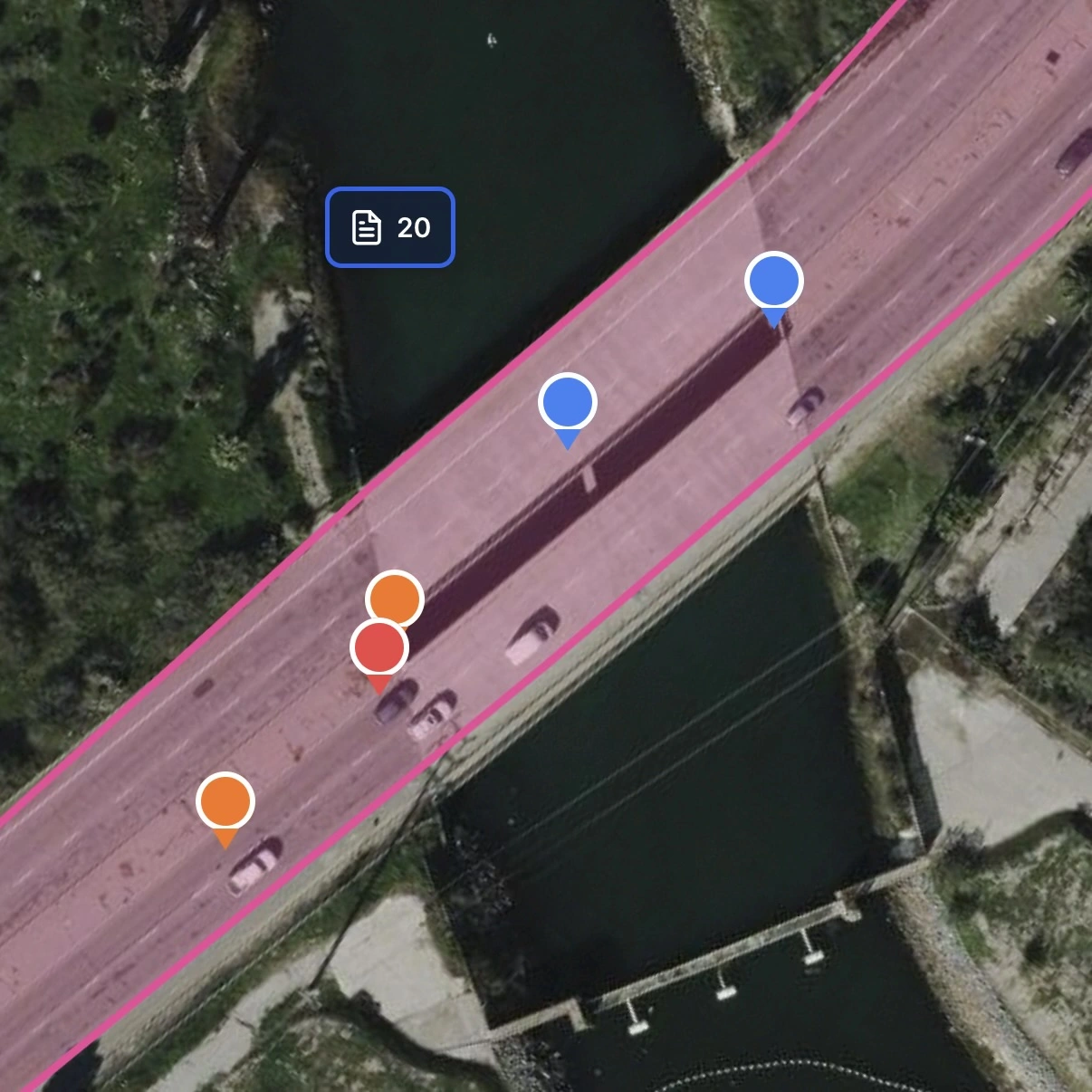
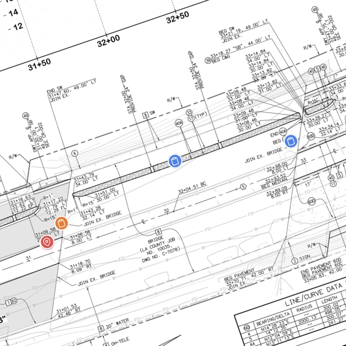
RFIs, directives, and field issues stay anchored to their real-world location. Switch between the live satellite map and an overlaid blueprint without losing context.
Blueprint Overlay
See exactly what was designed and where issues arise on the engineered plan sheet.
Live Map
Toggle to satellite view to coordinate crews and navigate the physical jobsite.
Why teams start looking for a Fieldwire alternative
Fieldwire is a well-built platform. The mismatch shows up when the tool was designed for a different team size, workflow type, or level of geographic visibility than the one you are running.
Per-user pricing that scales against you
Fieldwire's per-user model becomes expensive as a civil team grows. When a 5-person field team expands to include foremen, subs, and inspectors who all need project access, the bill grows with each seat. HeavyCivilHelper is priced for the way civil teams actually operate — not penalizing you for giving the agency inspector access.
No GPS map layer for field coordination
Fieldwire attaches tasks to plan sheet locations. HeavyCivilHelper puts every record on a live GPS satellite map. For corridor work — roads, utilities, pipelines — the GPS map is not a nice-to-have. It is how the superintendent understands which RFIs are open at which station and where the crew is working today.
Built for GC punch lists, not civil field coordination
Fieldwire's core use case is the GC punch list: walk a building, note deficiencies, assign to subs. Civil field coordination is a different workflow — RFIs that arise from plan conflicts at specific stations, directives that change scope mid-job, submittals tied to structures. HeavyCivilHelper was built specifically for that workflow.
Side-by-side comparison
| Feature | HeavyCivilHelper | Fieldwire |
|---|---|---|
| Core interface | GPS satellite map — every record is a pin at a coordinate | Plan viewer with task overlays |
| Primary use case | Civil field coordination: RFIs, directives, submittals by GPS location | GC punch lists and drawing markups |
| Pricing model | Flat rate — not per-user | Per-user (scales against growing teams) |
| RFI tracking | Each RFI is a GPS pin at the station where the conflict exists | RFI management added after original punch list focus |
| Directive tracking | Core record type pinned to the location where scope changed | Not a native record type |
| Plan overlays on satellite map | Upload plans and overlay on live GPS map at true coordinates | Plan viewer is the primary interface, not a map overlay |
| Mobile for field crews | iOS and Android — map-first, one tap to log an issue | iOS and Android — task and plan focused |
| Setup time | Same day, no implementation required | Same day to a few days depending on drawing upload workflow |
| Ownership | Independent | Owned by Hilti since 2021 — pricing has moved upmarket |
Specific features and pricing vary by vendor and contract. This comparison reflects general platform positioning, not a comprehensive feature audit.
Who HeavyCivilHelper is for
Good fit
- +Civil, utility, and road contractors managing corridor projects
- +Teams tracking RFIs, directives, and submittals by GPS station
- +Growing field teams where per-user pricing is a budget constraint
- +Contractors who need a live GPS map view for crews in the field
- +Public works projects with multi-party access (GC, subs, agency inspector)
Not the right tool if you need
- -GC teams whose primary workflow is punch lists and drawing markups
- -Commercial building projects where plan version control is the core need
- -Operations requiring deep task assignment and checklist workflows
- -Teams already invested in Fieldwire's drawing management system
What Comes in HeavyCivilHelper?
Not a rigid system. A toolkit you configure.
Put the location, field photos, records, plans, and work areas on one map your team can use.
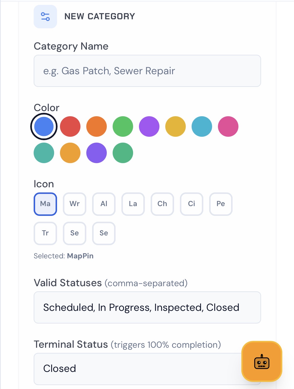
Set Custom Pins
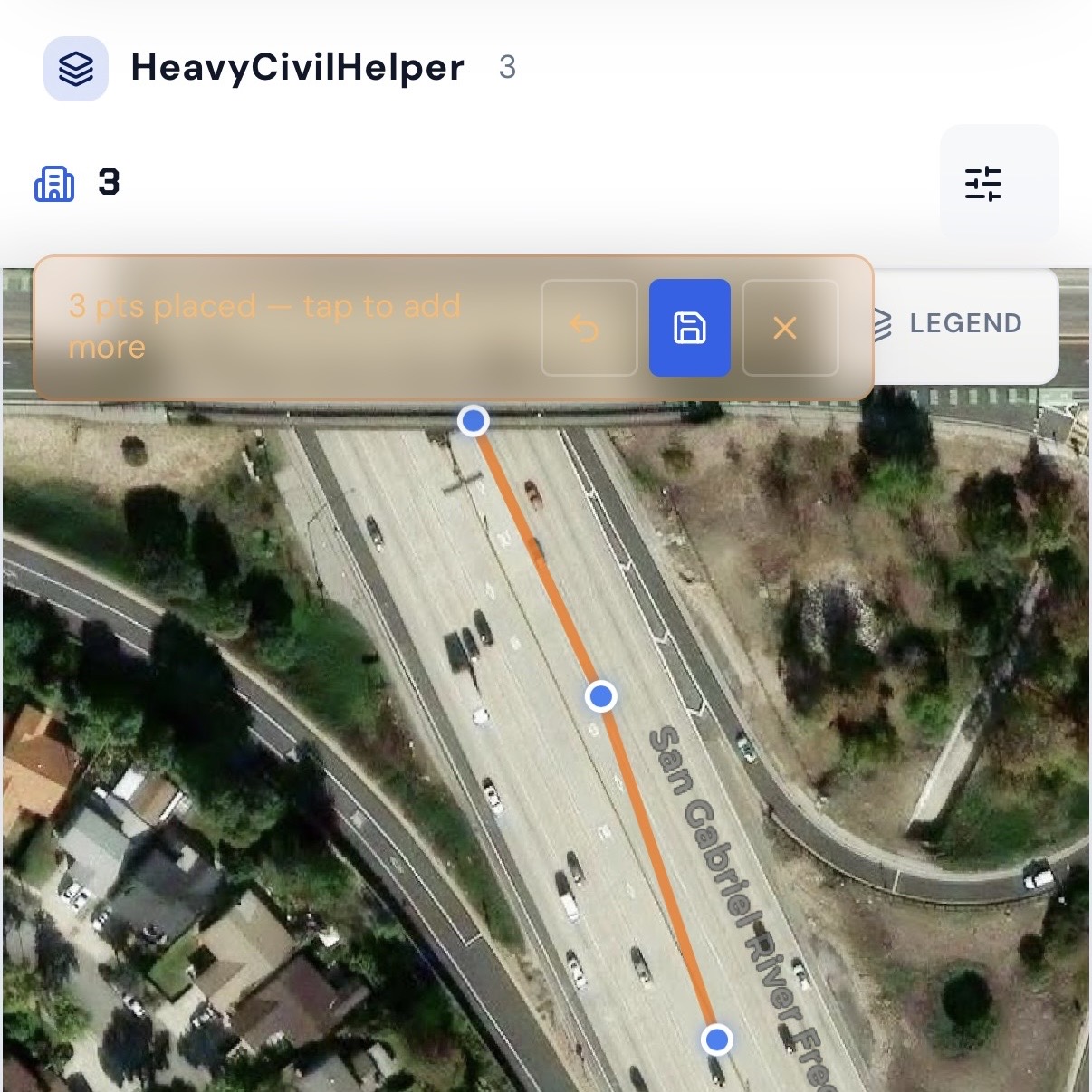
Draw Lines & Routes
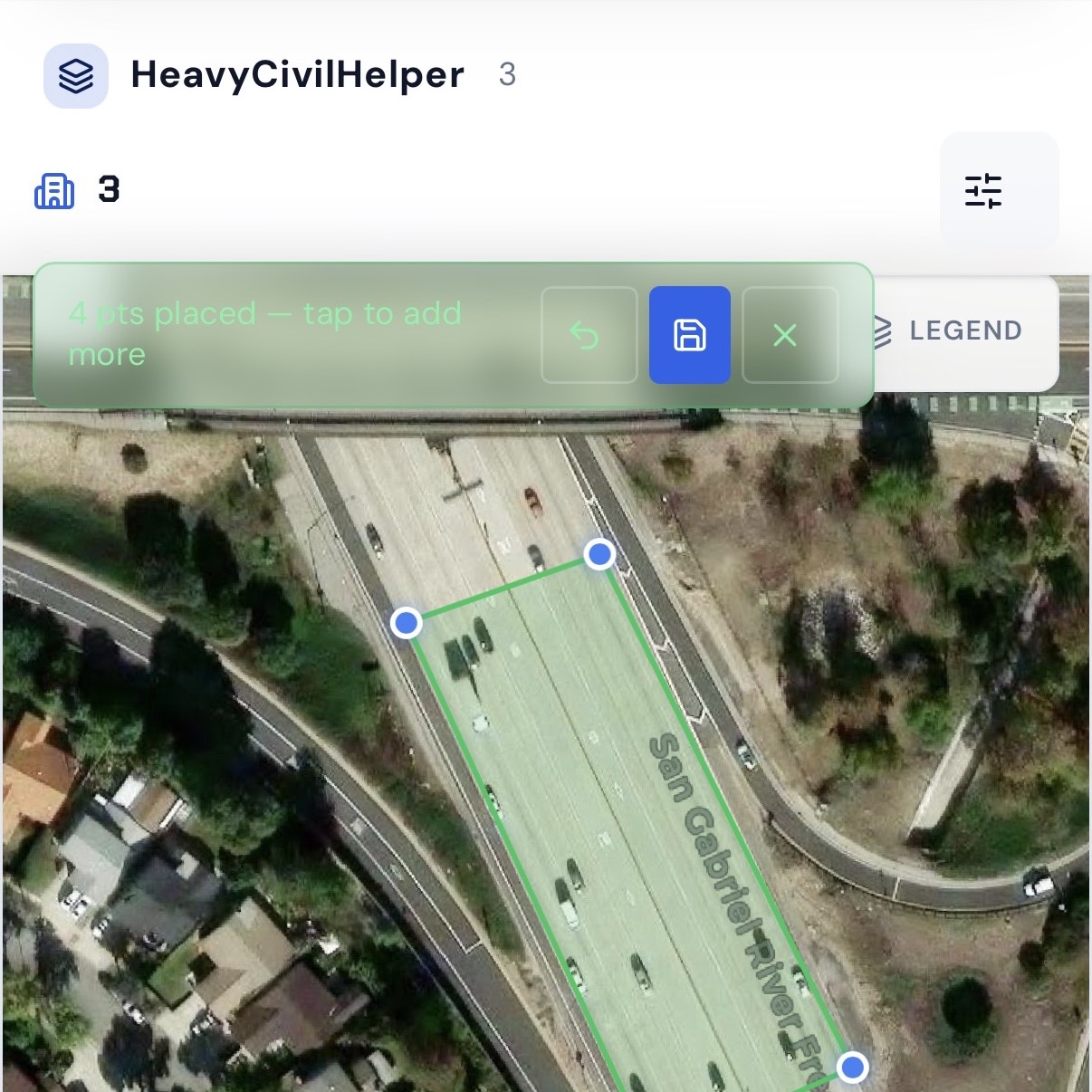
Group Work Zones and Phases
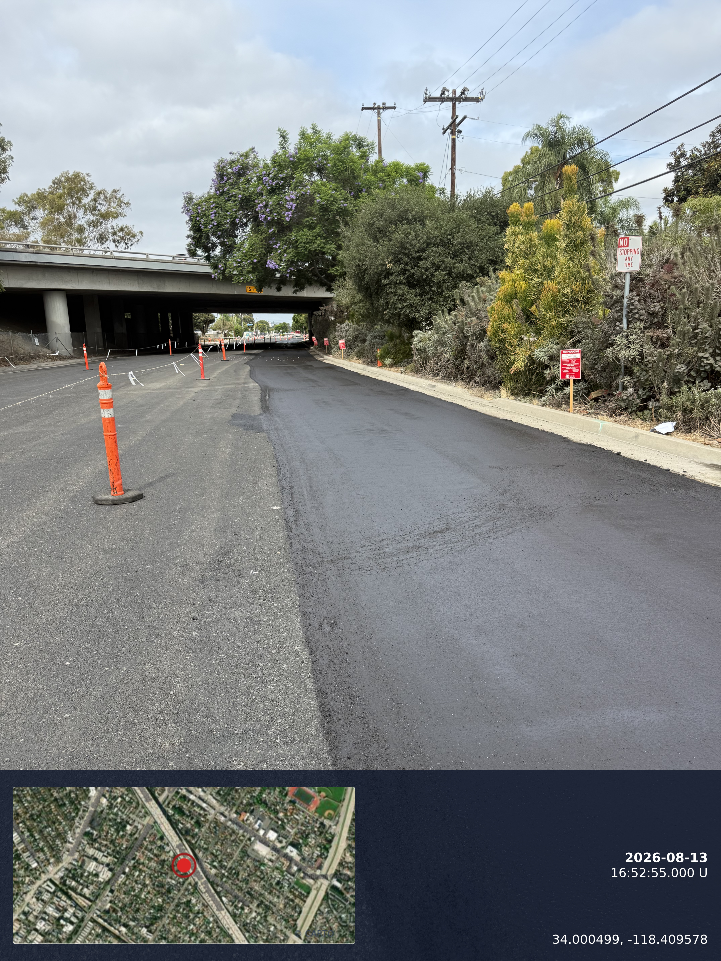
Timestamp Camera
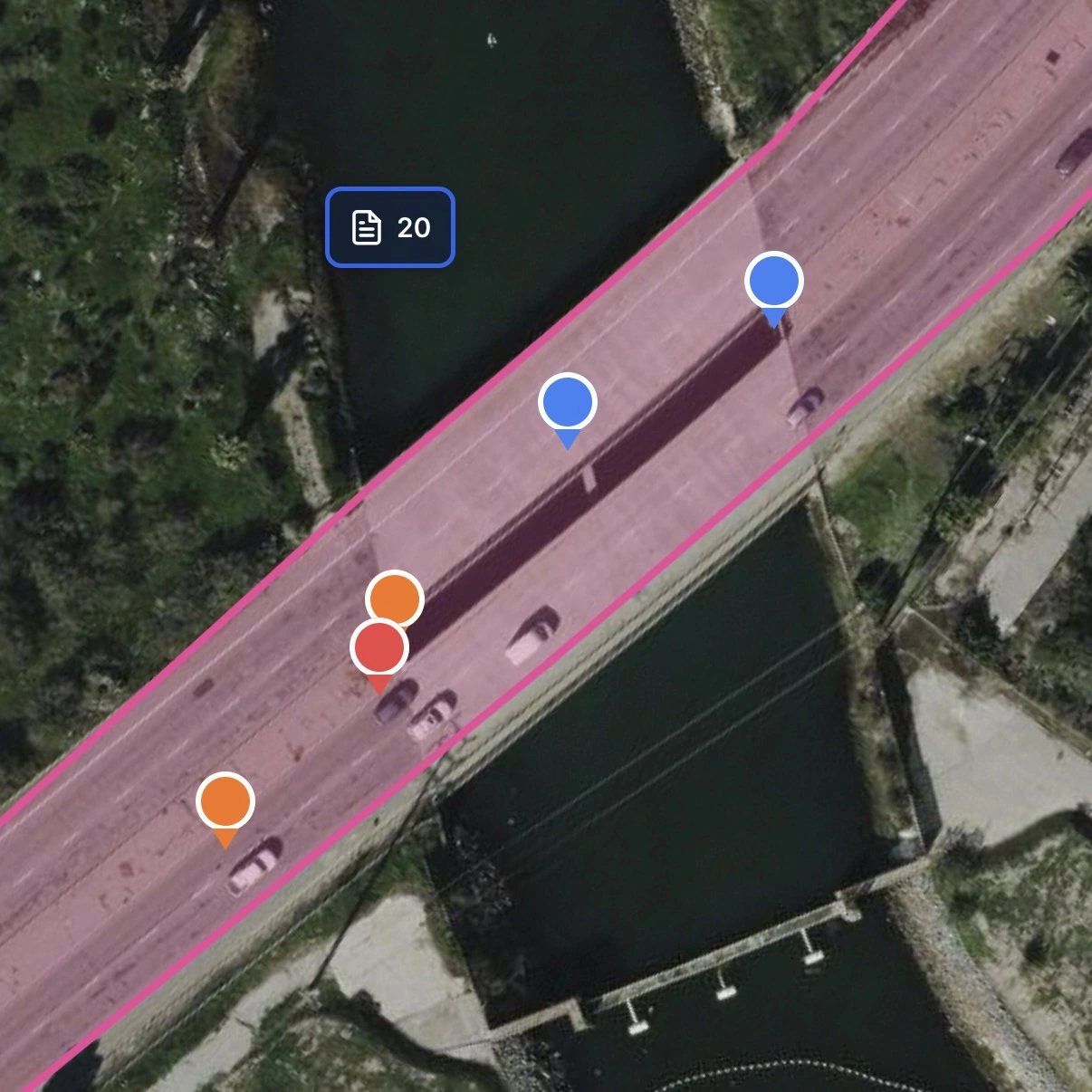
Track Multiple Records Pins
Overlay Plan Sheets
Create an account, choose Free, then add your first project.
Map-based construction workflows extend beyond heavy civil
HeavyCivilHelper supports three construction workflows: Civil & Infrastructure for civil and public works coordination, Building & Trades for active residential, commercial, and specialty jobs, and Bids & Estimates for pre-award opportunities.
Residential and specialty trades
Roofing, exterior, and specialty jobs need active-job visibility by location so crews, scope, and field notes stay connected.
Civil and utility contractors
Water main replacements, fiber installations, and corridor work are points or segments on a map before they are anything else.
Pre-award estimating teams
Bid locations, opportunity stages, site visits, and follow-up dates benefit from a visible pre-award pipeline.
Construction-adjacent field vendors
Material, environmental, and traffic-control teams can keep active site work and field records tied to the job location.
Traffic control and MOT operations
Lane closures, flagging locations, and TCP compliance points are defined by their geometry on the road network.
Independent construction crews
Small construction and specialty-trade crews can organize estimates and active jobs around the places where work is happening.
Frequently asked questions
Is HeavyCivilHelper trying to replace Fieldwire?
Not for the workflows Fieldwire was built for. If your team's primary need is punch list management and drawing markup on a commercial building project, Fieldwire is a solid choice. HeavyCivilHelper is built for civil field coordination — where every RFI, directive, and submittal needs to be pinned to a GPS coordinate on a live satellite map so field crews see what is active at their location. Different tools for different workflows.
What changed when Hilti acquired Fieldwire?
Since the Hilti acquisition in 2021, Fieldwire's pricing has moved upmarket and the product has been integrated into Hilti's broader construction technology portfolio. Several longtime users have noted that pricing increased and the product's direction has shifted toward larger commercial construction teams. Civil specialty contractors who were already on the edge of the per-user cost model have been the most affected.
How does HeavyCivilHelper handle RFIs differently than Fieldwire?
In HeavyCivilHelper, an RFI is a GPS pin at the exact station where the field question arose. The foreman at that location sees the RFI when they open the map, without searching for it. They can attach photos, view the plan overlay, and see which other RFIs are open in the same zone. In Fieldwire, RFIs can be attached to plan locations on a drawing sheet, but the primary interface is the plan viewer rather than a live GPS map. For corridor work where the team navigates by station, not drawing number, the GPS-first approach is a better fit.
What is HeavyCivilHelper's pricing model?
HeavyCivilHelper is priced to give entire civil teams access without per-seat cost that scales against you as the team grows. The intent is that a superintendent, foreman, PM, subcontractor crew lead, and agency inspector can all be in the same project without the software bill doubling. Contact us for current pricing.
Can I use Fieldwire and HeavyCivilHelper together?
Some teams do. If you use Fieldwire for drawing management and your GC requires it, HeavyCivilHelper can run alongside as the GPS field coordination layer — where RFIs, directives, and field issues are tracked by location on the corridor map. They operate at different layers and do not significantly overlap in daily use.
See the map-first field coordination layer in action
The heavy civil demo loads a real public works project with RFIs, directives, lane closures, and a plan sheet overlay on a GPS map. No login required.
Related
Public Works and Heavy Civil
How HCH handles RFIs, directives, and submittals on public works corridor projects.
Procore Alternative for Heavy Civil
Map-based field coordination vs enterprise PM platforms.
HCSS Alternative
Production quantity reporting vs GPS field coordination.
Map-Based Field Coordination
Why organizing civil work by GPS location changes how crews operate.
What Is an RFI in Construction?
How RFIs work and how to track them without losing the paper trail.